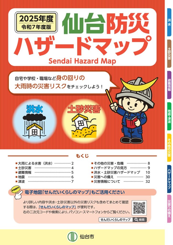
Provision of Disaster Risk Information (Hazard Maps)
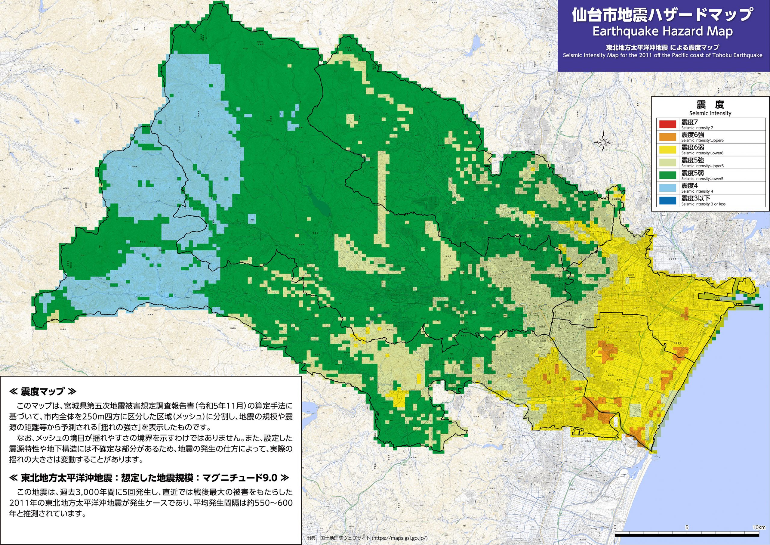
Earthquake Hazard Map
Based on the Fifth Miyagi Prefecture Earthquake Damage Estimation Survey Report published in November 2023, Sendai City is producing two types of earthquake hazard maps in 2025: a “Seismic Intensity Map” that indicates expected shaking based on the scale and proximity of four hypothetical hypocenters, and a “Liquefaction Hazard Map” that shows the potential risk of ground liquefaction due to shaking from the four hypocenters. Sendai City is divided into square areas, measuring 250 meters on each side, and the maps are created using this grid-based format.
Inquiries
Construction Guidance Section,
Urban Planning Bureau
tos009420@city.sendai.jp
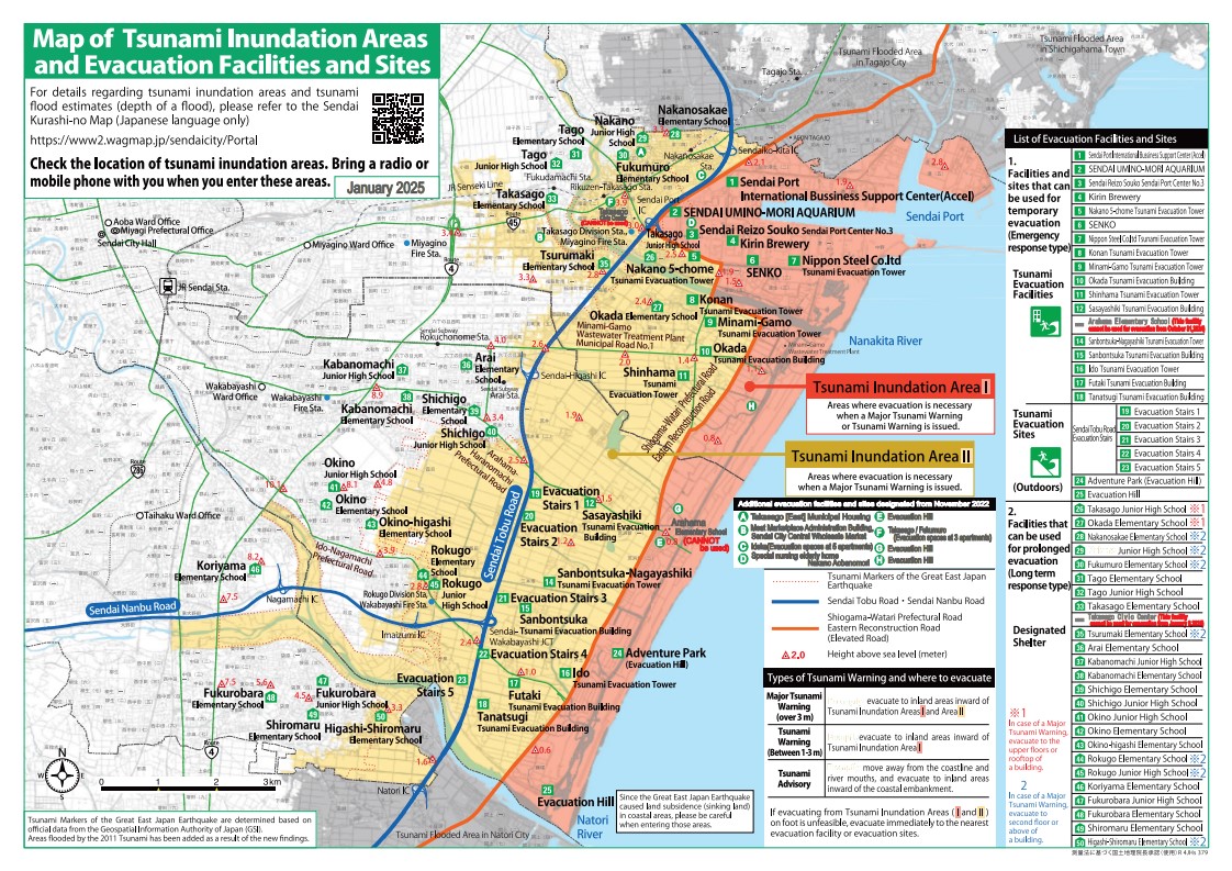
Map of Tsunami Inundation Areas and Evacuation Facilities and Sites
A tsunami evacuation map for Miyagino Ward was created with distribution starting in December 2010, and another was created and distributed for Wakabayashi Ward in February 2011. However, due to the extensive damage caused by the Great East Japan Earthquake that occurred just after this, the first “Tsunami Evacuation Guidelines (Preliminary Edition)” was published in October 2011 based on lessons we learned from the earthquake. Since then, the contents have been updated as needed in line with revisions to tsunami evacuation areas.
Inquiries
Disaster Risk Reduction Promotion Section,
Crisis Management Bureau
kks000130@city.sendai.jp
Sediment Disasters and Flood Damage
Since 2005, Sendai City has been producing and distributing the Sendai Flood Disaster Prediction Map. In recent years, however, the frequency of landslide disasters caused by heavy rainfall has continued to increase nationwide. In response, the City now creates and distributes the Sendai City Disaster Prevention Hazard Map, which identifies areas at risk of flooding or being affected by landslides, and summarizes key points on preparedness and actions to take in the event of a disaster. Maps are available at each ward office and on the City’s website.
- Links
Inquiries
Disaster Risk Reduction Promotion Section,
Crisis Management Bureau
kks000130@city.sendai.jp
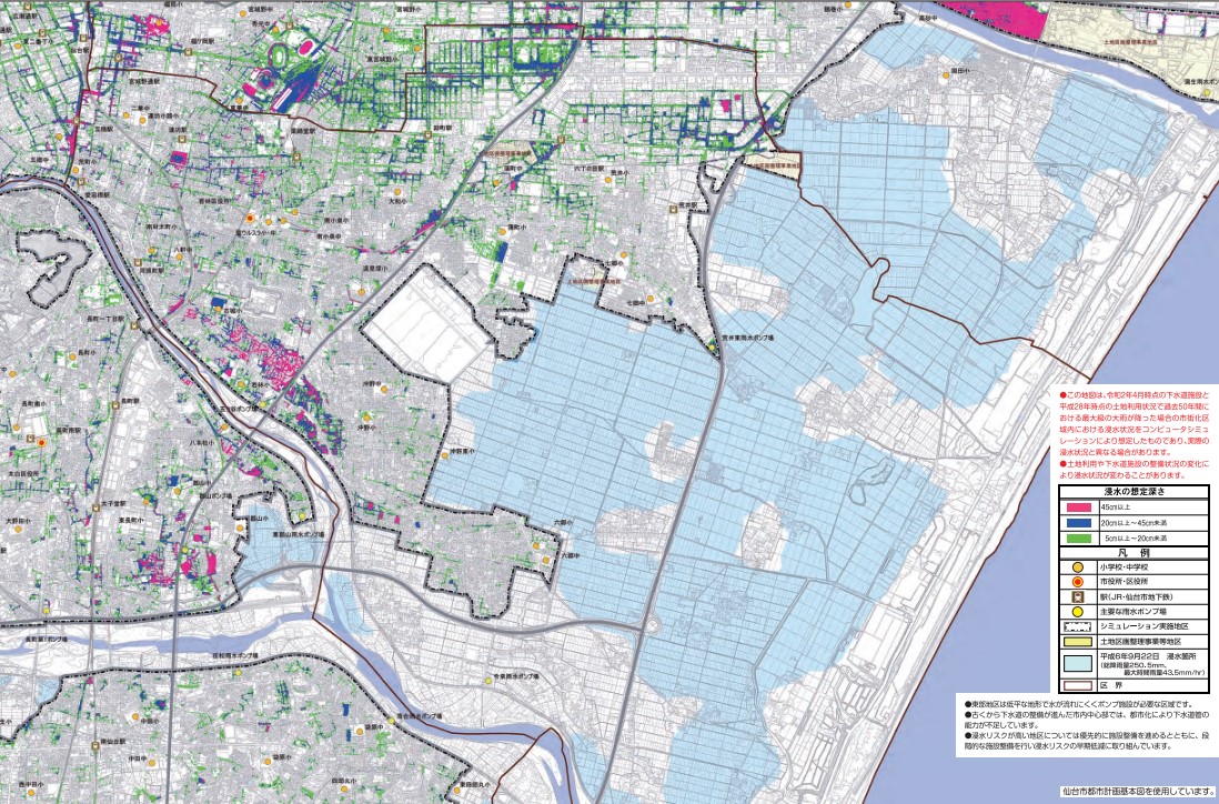
Inland Water (Map of Assumed Flood Areas)
This map is based on simulations of potential flooding if rainfall equivalent to the record-level downpour on October 12–13, 2019—the heaviest in the past 50 years—were to occur across the entire sewerage service area. The map also includes precautions to take during flooding, making it useful for everyday preparedness in the event of an emergency.
Inquiries
Sewerage Planning Section,
Construction Bureau
ges011210@city.sendai.jp
Information on Residential Land Development History
4 types of map were created in April 2013 to be used as reference when residents consider the safety of residential land and buildings. The maps show the distribution of cut and filled earth in residential land, development history, and so on. Sendai was the first city in Japan where these were made public.
Inquiries
Development Coordination Section,
Urban Planning Bureau
tos009410@city.sendai.jp
Progress of Hazard Map Development
| From 1998 | Assumed Flood Damage Map for Sendai made and distributed in 2005 |
| 2008 | Earthquake Hazard Distribution Map made |
| 2009 | |
| 2010 | Tsunami Evacuation Map for Miyagino Ward made and distributed |
| 2011 | Tsunami Evacuation Map for Wakabayashi Ward made and distributed Great East Japan Earthquake First version of the Tsunami Evacuation Guidelines (Preliminary Edition) made |
| 2012 | |
| 2013 | ・Information Map for Sendai Residential Land Development History and Inland Water Hazard Map distributed ・Second version of the Tsunami Evacuation Guidelines (Preliminary Edition) made |
| 2014 | ・Sediment Disaster Hazard Map distributed ・Third version of the Tsunami Evacuation Guidelines (Preliminary Edition) made |
| 2015 | ・Sendai Flood and Sediment Disaster Hazard Map for each ward made and distributed |
| 2016 | ・Detailed versions of the Flood and Sediment Disaster Hazard Map made and distributed ・Fourth version of the Tsunami Evacuation Guidelines (Preliminary Edition) planned |
| 2017 | Preparation and distribution of the FY 2017 edition of the Sendai Disaster Prevention TownPage |
| 2018 | Preparation and distribution of the FY 2018 edition of the Sendai Disaster Prevention TownPage |
| 2019 | Preparation and distribution of the FY 2019 edition of the Sendai Disaster Prevention TownPage |
| 2020 | Preparation and distribution of the FY 2020 edition of the Sendai Disaster Prevention Hazard Map Preparation of the 5th edition (provisional version) of the Tsunami Evacuation Guide Additional publication of the hazard map for designated high-risk reservoirs |
| 2021 | Preparation and distribution of the FY 2021 edition of the Sendai Disaster Prevention Hazard Map Revision of the city’s expected inundation areas into mapped zoning format |
| 2022 | Preparation of the 6th edition of the Tsunami Evacuation Guide Preparation and distribution of the FY 2022 edition of the Sendai Disaster Prevention Hazard Map |
| 2023 | Preparation and distribution of the FY 2023 edition of the Sendai Disaster Prevention Hazard Map |
| 2024 | Preparation and distribution of the FY 2024 edition of the Sendai Disaster Prevention Hazard Map |
| 2025 | Preparation and distribution of the FY 2025 edition of the Sendai Disaster Prevention Hazard Map |